Currently, the Smart City establishment is a hot research topic, which involves the collection of multiple database together for better urban environment understanding. Visualization of 3D information of urban area will provide more information for decision making process as it can directly engage users into virtually developed models which is close to the reality.The establishment of 3D City Model can be used as spatial data as a basis for 3D city information systems for land use planning and design, with the support of data analysis and data modelling.
CityGML, which was regarded as a worldwide open-sourced standard of 3D urban environment description, has been applied to multiple cities for the establishment of urban models by storing various characteristics in addition to geometry and appearance as well as being visualized through QGIS. In addition, with the increasing open data of 3D information, there are many opportunities for further development of 3D modelling and visualization in low cost with the combination of 2D open-sourced data.
This study will focus on the downtown area in Shanghai, and try to establish a urban model under CityGML standard. The ideal method to achieve the reconstruction of urban model is try to utilize Airborne LiDAR as data source together with the accurate building footprints from cadastral map by application the comprehensive method of combining LiDAR and Photogrammetry. The main LoD level of the established model will achieve LoD2 level, with extracted roof structure as well as texture mapping. As CityGML represents urban model in a XML format file, which could be further applied for modelling and data analysis for the urban phenomenon such as “solar potential, pollution, heat stress and infiltration capacity” , including specific attributes represented in a specific coding. The other task this study is to transform the 3D reconstructed model to a CityGML format for later modelling purposes.
###Plan A
Previous Airborn LiDAR in Lu Jiazui District of Shanghai
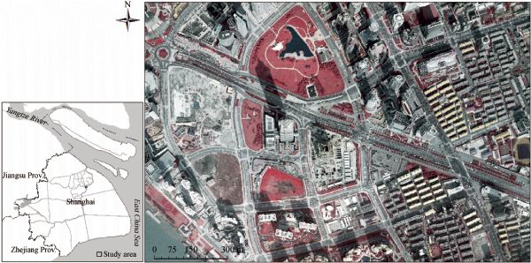
Sample aerial image of Lu Jiazui District of Shanghai
The established 3D urban model in CityGML format will be further applied as the database for various modelling in urban area in order to achieve the sustainability during urbanization process.
Expected Results in Lu Jiazui District of Shanghai
This work was carried out at the International Doctoral Innovation Centre (IDIC). The authors acknowledge the financial support from Ningbo Education Bureau, Ningbo Science and Technology Bureau, China's MOST, the University of Nottingham, and Laboratory for Urban Complexity And Sustainability. The work is also partially supported by EPSRC grant no EP/L015463/1.